
Best Kayak and Paddleboard Spots Near Sarasota: 5 Launches Compared
Five Sarasota-area launches are not interchangeable. Choose by water exposure, craft, route commitment, access friction and current conditions — not by whichever list you found first.
Researched from official sources, not a trip report
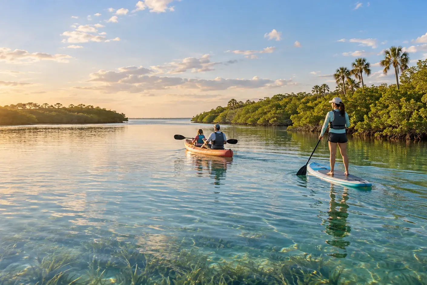
Search for paddling near Sarasota and you get a list. A list implies the places are interchangeable, and these five are not. They differ in the thing that actually decides your morning: how exposed the water is, whether a board or a boat suits it, how far you are committed once you push off, and how much friction stands between the car and the water.
All five are researched PaddlePin locations. What follows compares them on those four axes, using the facts in each record and the official sources rechecked for this guide. Where a record leaves something unrated or unrecorded, this page says so rather than filling the gap.
The five at a glance
| Launch | Water | Route commitment | Access |
|---|---|---|---|
| South Lido / Ted Sperling | Mangrove tunnels and bayou, opening to Sarasota Bay | Tunnel route rated beginner; the bay extension is unrated | Dedicated non-motorised launch, 27 paved spaces, 6 a.m.–10 p.m. |
| Turtle Beach | Sheltered Little Sarasota Bay and Intracoastal | 1-mile preserve loop, rated beginner | County launch plus an accessible launch and wash station, 6 a.m.–10 p.m. |
| Oscar Scherer State Park | Brackish blackwater creek through mangroves and palms | 2-mile out-and-back, rated beginner | Accessible launch; $5 per vehicle; 8 a.m.–sunset |
| Myakka River State Park | River and lake; level changes the outing | Lake exploration rated beginner; both river routes unrated | Two carry-in launches; $6 per vehicle; 8 a.m.–sunset |
| Robinson Preserve | Internal mangrove blueways and Palma Sola Bay | Internal trails rated beginner; the 5-mile bay run is unrated | Two carry-in launches in Bradenton; seasonal hours |
Difficulty ratings and distances are the ones carried on each PaddlePin location record. Routes shown as unrated have no rating on the record, which is not the same as easy.
The short answer
Protected-water beginners: Turtle Beach. A one-mile loop rated beginner, inside sheltered bay water, from a county launch that also has an accessible canoe and kayak launch and a wash station. It asks the least of a new paddler of the five.
Stand-up paddleboards: Turtle Beach first, Robinson Preserve for distance. Open, protected bay water suits a board better than tight mangrove turns do. Turtle Beach keeps the commitment to a mile; Robinson’s internal blueways offer more than three miles of sheltered trail if you want a longer flatwater day.
Wildlife and natural scenery: Myakka River. River and lake inside a large state park, where the record names alligators, heat and route-finding in flooded hammocks among its hazards. That is the trade: the wildest water here is also the one with the most variables.
A longer or more committed route: Robinson Preserve. The five-mile round trip out to Palma Sola Bay is the longest route carried on any of these five records, and it is unrated — the record flags open-water exposure once you leave the internal trails.
Straightforward access: Turtle Beach or South Lido. Both are county parks open 6 a.m. to 10 p.m. with no gate fee recorded, against 8 a.m. to sunset and a per-vehicle fee at the two state parks.
How to choose, in four questions
1. How exposed is the water?
Sheltered and open water sit close together here, and the records draw the line explicitly. South Lido’s tunnels are protected, but the record names open-bay exposure if you leave them. Robinson’s internal blueways are sheltered; the run to Palma Sola Bay is flagged for open-water exposure. Turtle Beach sits in Little Sarasota Bay, which the record notes has been connected to the Gulf through Midnight Pass since October 2024. Protected-looking water is not automatically protected water once you cross a boundary the record has marked.
2. Board or boat?
None of these records carries a craft rating, so treat this as PaddlePin’s reading of the recorded water types rather than a rated fact. Mangrove tunnels reward a kayak: South Lido and Robinson both carry navigation complexity as a named hazard, and tight turns are harder on a board. Open, protected bay — Turtle Beach, Robinson’s wider trails — suits a paddleboard. Myakka’s current and low-water portaging make it the least board-friendly of the five.
3. How far are you committed once you start?
A one-mile loop and a five-mile out-and-back are different days. Of the routes on these records, three are rated beginner — Turtle Beach’s one-mile preserve loop, Oscar Scherer’s two-mile creek out-and-back, and South Lido’s tunnel-and-bayou route — while Robinson’s bay run, Myakka’s two river routes and South Lido’s bay extension are all unrated. An out-and-back lets you turn round at any point. A loop and an open crossing do not.
4. What friction stands between the car and the water?
The two county parks open at 6 a.m. and close at 10 p.m., and no entrance fee is recorded for either. Oscar Scherer and Myakka open at 8 a.m., close at sunset, and charge $5 and $6 per vehicle respectively. Turtle Beach carries the most access detail of the five: the county lists a canoe and kayak launch, a separate accessible canoe and kayak launch, a canoe and kayak wash station and restrooms. South Lido’s record puts 27 paved spaces plus designated loading spaces and a grass trailer area at its non-motorised launch.
Turtle Beach: the most forgiving first paddle
Why it stands out
The Jim Neville Marine Preserve loop is one mile and rated beginner — the shortest rated route in this comparison. It runs in sheltered Little Sarasota Bay from the county launch on the south end of Siesta Key, at 8918 Midnight Pass Road, open 6 a.m. to 10 p.m.
Access is the strongest part. Sarasota County lists a canoe and kayak launch, an accessible canoe and kayak launch, a canoe and kayak wash station, restrooms and a boat ramp at the park. For a group that includes someone who needs a graded entry to the water, this is the only one of the five where the county names an accessible launch outright.
The trade-off
Sheltered is not the same as empty. The record names three hazards: motorboat traffic when crossing the Intracoastal Waterway near the Blackburn Point bridge, the tidal behaviour of Midnight Pass — an open inlet to the Gulf since October 2024 — and slow-speed manatee refuge waters in Little Sarasota Bay. The loop itself is modest; the water it sits in is working water.
On rentals, the record lists SURFit USA as offering guided kayak and paddleboard tours and rentals at Turtle Beach, stated by the operator on 13 September 2026. That listing is off-site rather than a counter at the launch, and the record says in its own words that other vendors also operate and that the listing is not a recommendation or a ranking. Confirm times, prices and availability with any operator for your own date.
Choose this one if… you want the lowest-commitment rated route here, you are launching a paddleboard, or someone in the group benefits from an accessible launch and a wash station.
Turtle Beach Park - Jim Neville Marine Preserve Loop
Beginner routeSouthwest Florida · Sarasota County · Little Sarasota Bay / Turtle Beach tidal lagoon
A sheltered one-mile loop around the Jim Neville Marine Preserve in Little Sarasota Bay, from the county canoe and kayak launch at Turtle Beach Park on the south end of Siesta Key.
South Lido / Ted Sperling: mangrove tunnels with a bay escape hatch
Why it stands out
South Lido is the mangrove-tunnel paddle of the group. The record describes a dedicated non-motorised launch into Brushy Bayou and the South Lido tunnel network, and rates the tunnel-and-bayou route beginner. Its water types run from mangrove tunnel and creek through estuary and bay, which is unusually wide range from a single launch.
The launch is purpose-built rather than shared with trailers: the record puts 27 paved spaces at it, plus designated loading spaces and a grass trailer area, and the park is open 6 a.m. to 10 p.m. with no entrance fee recorded. Rentals are listed as multiple permitted Sarasota County vendors operating on site, without a single named operator.
The trade-off
No distance is recorded for the tunnel network, so plan by time and turnaround rather than mileage. The record names navigation complexity as a hazard — mangrove tunnels look alike, and the way back is not always obvious — alongside tide and wind. The Sarasota Bay extension is a separate, unrated route with open-bay exposure; treat leaving the tunnels as a decision, not a continuation.
Choose this one if… you specifically want mangrove tunnels, you are in a kayak rather than on a board, and you are content to plan the outing by turnaround time because no route distance is recorded.
Ted Sperling Nature Park - South Lido Mangrove Tunnels
Beginner routeSouthwest Florida · Sarasota County · Sarasota Bay / Brushy Bayou / South Lido mangrove tunnels
A highly accessible Sarasota paddle from a dedicated non-motorized launch into Brushy Bayou and the South Lido mangrove tunnel network.
Oscar Scherer State Park: a quiet creek with a rated distance
Why it stands out
South Creek is a brackish blackwater creek running through mangroves and palms inside the state park, and its out-and-back is the one route here with both a rated difficulty and a firm distance: two miles, beginner. An out-and-back on a narrow creek is the easiest shape to abandon early, which is what makes it a reasonable first creek paddle.
There are two launches on the record — an accessible launch at the South Creek Picnic Area and a primitive ramp across from the ranger station. The park is open 8 a.m. to sunset, 365 days a year, and the entrance fee is $5 per vehicle.
The trade-off
The record names tide and low-water launch difficulty first among its hazards, then alligators, heat and natural creek obstacles. A blackwater creek at low water is a different proposition from the same creek on a higher tide. No rental operator is recorded at Oscar Scherer, so plan on bringing your own craft unless you confirm otherwise with the park.
Choose this one if… you want a short, shaded, clearly-bounded paddle with a known distance, you are bringing your own boat, and you can time the trip against the tide rather than the calendar.
Oscar Scherer State Park - South Creek
Beginner routeSouthwest Florida · Sarasota County · South Creek / tidal connection toward Gulf waters
A quiet brackish blackwater creek paddle through mangroves and palms inside a Sarasota-area state park, with an accessible launch and camping nearby.
Myakka River State Park: the wildest water, and the most variables
Why it stands out
Myakka is the big-nature option. The record describes a major Florida river paddle where water level changes the experience dramatically — from shallow dry-season portages to strong wet-season current — across a river and a lake inside one of the state’s largest parks. Upper Myakka Lake exploration is rated beginner; the bridge-launch river out-and-back and permitted river travel south of SR 72 are both unrated.
Two carry-in launches are recorded: one at the bridge a mile inside the SR 72 entrance, and one on Upper Myakka Lake near the concession. Myakka Outpost is listed as renting canoes and single kayaks; the park describes it as locally owned and operated by the same family since 1982. The park is open 8 a.m. to sunset year-round at $6 per vehicle, and the North Gate keeps shorter hours — Saturdays, Sundays and state holidays, 8 a.m. to 5 p.m.
The trade-off
This record carries the longest hazard list of the five: strong wet-season current, low-water portaging, alligators, heat and route-finding in flooded hammocks. Water level is the variable that decides which of those you meet, and it is not something you can read from home on the morning of the trip. Check conditions with the park.
One current operational note: the park’s own page states that drinking water is temporarily unavailable and asks visitors to bring their own, with free bottled water at the ranger station from 8 a.m. to sunset. Confirm whether that still applies before you go.
Choose this one if… wildlife and landscape are the point, you are in a kayak or canoe rather than on a board, and you are willing to let the current water level choose the route for you.
Southwest Florida · Sarasota County · Myakka River / Upper Myakka Lake
A major Florida river paddle where water level changes the experience dramatically, from shallow dry-season portages to strong wet-season current.
Robinson Preserve: the longest route, and the one outside Sarasota County
Why it stands out
Robinson Preserve is in Bradenton, in Manatee County rather than Sarasota County — worth knowing before you plan the drive. It earns its place because it is the only one of the five offering a genuinely longer day: the record describes more than three miles of internal mangrove and tidal paddling trails, rated beginner, plus an optional five-mile round trip out to Palma Sola Bay.
Two carry-in launches are recorded — one near the north entrance and one at the south end, at the Expansion. Manatee County does not list an entrance fee for the preserve.
The trade-off
The two halves of this place are not the same outing. The internal blueways are sheltered and rated beginner. The Palma Sola Bay run is unrated and the record flags open-water exposure the moment you leave the internal trails, alongside tide, mangrove navigation and lightning.
Hours are the open question. The preserve runs seasonal opening times that shift through the year, and the county material available for this guide was not current enough to publish a specific window — so check the county listing for the date you intend to go rather than trusting a time quoted anywhere, including here. Parking at the south launch is recorded as unknown. No rental operator is recorded.
Choose this one if… you want more than a couple of miles of sheltered paddling, you are bringing your own craft, and you will confirm the preserve’s hours for your date before committing to the drive north.
Robinson Preserve - Internal Blueways to Palma Sola Bay
Beginner routeSouthwest Florida · Manatee County · Robinson Preserve tidal creeks / Perico Bayou / Palma Sola Bay
A large Bradenton coastal preserve with more than 3 miles of internal mangrove/tidal paddling trails and an optional 5-mile roundtrip to Palma Sola Bay.
Conditions, weather and skill caveats
Four of these five records name tide among their hazards, and it is the variable most likely to change a Sarasota-area paddle from the one you planned. Low water makes launches harder at Oscar Scherer, changes what is passable in mangroves at South Lido and Robinson, and at Myakka can mean portaging.
Wind and open-water exposure are the second theme. South Lido, Robinson and Turtle Beach all have a sheltered core and an exposed edge, and the records draw that line for each. A forecast that looks fine for a bayou can be wrong for a bay crossing.
Lightning is named explicitly at Robinson Preserve, and Florida afternoon storms are a regional pattern rather than a local one. Heat is named at Oscar Scherer and Myakka. Alligators are named at both state parks, which are the two freshwater-influenced sites here.
Motorised traffic matters at Turtle Beach, where crossing the Intracoastal near the Blackburn Point bridge is a named hazard, and Little Sarasota Bay is a slow-speed manatee refuge. Give manatees room and keep your own speed down.
None of this replaces a conditions check on the day. Park hours, fees, rental operations and water conditions all change, and several of the facts on this page are dated to 15 September 2026.
What this guide does not claim
This is desk research against official sources and PaddlePin’s own location records. It is not a trip report, and it is worth being precise about the limits.
- No launch here has been field checked by PaddlePin. Every one of the five records carries a field-checked status of false. Nothing on this page is a firsthand observation.
- No craft rating exists on these records. Where this guide suggests a board or a boat, that is a reading of the recorded water types and hazards, labelled as such, not a rated fact.
- Several routes have no recorded distance — South Lido’s tunnels, both Myakka river routes, Robinson’s internal trails beyond “more than three miles”. None has been estimated here.
- Rental availability is not recorded at Oscar Scherer or Robinson Preserve, which means unrecorded rather than absent. Confirm with the park if renting matters to your plan.
- Robinson Preserve’s current seasonal hours could not be confirmed from a source current enough to publish, so no specific window is given.
Which one should you choose?
- Protected-water beginners: Turtle Beach — a one-mile rated loop in sheltered bay water, with the only county-listed accessible launch of the five.
- Stand-up paddleboards: Turtle Beach for a short, open, protected loop; Robinson Preserve’s internal blueways when you want distance without tight turns.
- Wildlife and natural scenery: Myakka River — with the clear understanding that its hazard list is the longest here and water level governs the day.
- A longer or more committed route: Robinson Preserve’s five-mile Palma Sola Bay round trip, which is unrated and exposed, or Myakka’s unrated river routes.
- Straightforward access: Turtle Beach or South Lido — 6 a.m. to 10 p.m., no recorded entrance fee, and dedicated non-motorised launch facilities.
- Mangrove tunnels specifically: South Lido, in a kayak.
Official sources checked September 15, 2026
- Sarasota County — Turtle Beach Park facility directory
- Florida State Parks — Oscar Scherer State Park
- Florida State Parks — Myakka River State Park
- Manatee County — Robinson Preserve
Route distances, difficulty ratings, hazards, launch details and rental listings are drawn from the five PaddlePin location records linked below, which carry their own sources.
Explore the exact paddles on PaddlePin
More Florida water: explore every researched location, or go back to all guides.